 WORLD NEWS VIEW
IMD 14 October forecast: hailstorm risk in Delhi, Punjab and Haryana explained
IMD warnings issued on October 13 flagged lightning, thunderstorms and possible hail for October 14–15. District risks and practical preparation.
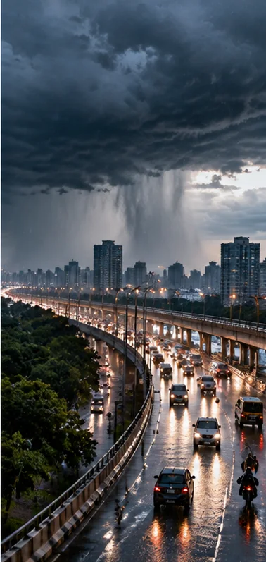
Published 14 October 2026 (IST); underlying reporting: 13 October 2026 bulletin; 14–15 October outlook.
Why 14 October weather alerts deserve a fresh report
India's national weather service issued a 13 October outlook warning of thunderstorms, lightning and possible hail across parts of northern India on 14 and 15 October. The India Meteorological Department's subdivision-level warning page identified thunderstorm and lightning conditions for Haryana, Chandigarh and Delhi, as well as Punjab, and listed hailstorm risk on the following days. News reports also described unsettled conditions over the Himalayan region and expected rainfall in parts of southern India. This is a new forecast window rather than a repetition of a previous day's observed rain. Weather information can change quickly as conditions evolve, so anyone planning travel or outdoor work should consult the latest local IMD bulletin shortly before departure. A region-wide warning does not mean every street or village will experience hail or strong wind.
Which places were under warning
The subdivision bulletin available with a 13 October issue date listed thunderstorms and lightning for Haryana, Chandigarh and Delhi on 14 October, alongside a hailstorm warning. Punjab had a similar outlook. Reports based on the all-India bulletin discussed showers and gusty winds in northern states, with isolated heavy rainfall possible in some Himalayan areas. Southern regions were also monitoring increased rainfall associated with seasonal patterns. Exact districts and warning categories matter: a state-sized forecast covers a large area, while a local nowcast can describe a smaller zone and shorter time. WNV does not replace district-specific updates with a single national 'red alert' headline. Readers should verify the geographic label, issue time and valid period on every warning map before changing plans.
What a thunderstorm warning actually means
A thunderstorm combines atmospheric instability, moisture and rising air to produce clouds capable of lightning, rain and sometimes strong gusts. An alert says conditions are favourable or that an event is possible or expected; it does not confirm an event has already happened at the reader's location. Some storms pass quickly, while others affect transport or agriculture for longer. Weather forecasts have uncertainty because small changes in atmospheric conditions can alter a storm's path and intensity. The useful response is proportionate readiness, not panic. Before travel, check real-time IMD information and local authority instructions. If thunder is audible, lightning can be a concern even before heavy rain reaches your street. A clear distinction between forecast risk and observed conditions prevents people from mistaking tomorrow's possibilities for today's facts.
How hail forms and why forecasts vary
Hail forms within powerful storm clouds when strong upward air currents carry water droplets into colder regions where they freeze and may accumulate additional layers. Whether hail reaches the ground depends on cloud conditions, the strength of the updraft and what happens as hailstones fall through warmer air. Predicting hail for one precise neighbourhood is difficult compared with describing a broader area at risk. An isolated hailstorm can damage vehicles, roofing, orchards and standing crops without affecting a neighbouring area. That is why official alerts often use expressions such as 'isolated' or 'likely' rather than announcing that hail will strike every district. Farmers and motorists should understand those probabilities and follow local alerts rather than sharing a dramatic photo from somewhere else as evidence of their own forecast.
The importance of gusty winds
A strong gust can cause problems even when rainfall is moderate. Temporary structures, loose metal sheets, tree branches and overhead cables may be vulnerable, especially where previous storms have weakened them. The October 13 IMD-based report described possible gusts up to around 60 kilometres per hour in some northern areas, though actual conditions differ by location. People should avoid sheltering under trees during active thunderstorms, secure lightweight outdoor objects and consider postponing high-risk outdoor activities. It is not sensible to turn a forecast maximum into a claim that winds of that speed will occur everywhere. For construction sites, event organisers and rural households, preparing for a short sharp gust can be just as important as watching the accumulated rainfall total.
Why transport can be affected
Thunderstorms and heavy showers can reduce road visibility, create temporary standing water and slow traffic even when the route is not fully flooded. Hail may make roads slippery and can damage exposed vehicles. Lightning can disrupt open-air activities, while severe local weather can delay airport operations or affect rail services. These are potential impacts, not claims that any particular flight or train has already been cancelled. Travellers should check with transport operators directly and leave extra time when warnings overlap the journey. Drivers should reduce speed according to conditions, maintain distance and never deliberately enter water of unknown depth. The most reliable travel decision combines current observations, local alerts and the service operator's notice rather than relying on a national headline alone.
The north-south weather contrast
India is geographically large enough for very different weather regimes to coexist. In the north, a particular spell of thunderstorms may affect Punjab, Haryana, Delhi and neighbouring regions. At the same time, parts of the south may be preparing for heavier rains linked to the seasonal transition and approaching northeast-monsoon conditions. Reports around 13 October mentioned possible heavy rainfall in areas including coastal Andhra Pradesh, Kerala, Karnataka or Tamil Nadu over different parts of the forecast period. The timing and district details are not identical across those states. A family travelling between regions may therefore face two different sets of advisories, not a single nationwide storm. The correct bulletin must match the destination and day.
Southwest withdrawal and northeast-monsoon transition
Autumn is a transition period in India's seasonal weather system. As the southwest monsoon withdraws, the pattern of rainfall and winds changes, and southern India begins watching for the onset of the northeast monsoon. Conditions becoming favourable for onset should not be reported as an official onset declaration until the meteorological agency issues one. Nor does withdrawal from one region mean no rain can occur there afterward. Local thunderstorms are still possible under suitable atmospheric conditions. The distinction helps explain why headlines may simultaneously discuss withdrawing monsoon conditions and rain warnings. Those statements can both be true because they refer to different geographic areas, times and weather mechanisms. Readers should resist trying to infer one state's daily forecast from a national seasonal label.
Advice for farmers and outdoor workers
Hail and strong wind can damage vulnerable crops, orchards, nurseries and temporary farm structures. The safest preparations depend on crop type, growth stage, irrigation conditions and whether a local agricultural advisory is available. Farmers should consult district agriculture departments or agrometeorological bulletins rather than assume a general storm forecast recommends immediate harvesting or spraying. Applying chemicals before rain without suitable guidance can waste money and raise safety risks. Outdoor workers should monitor lightning conditions, identify a substantial indoor refuge and avoid exposed high points during storms. People operating electrical equipment need particular care around wet surfaces and damaged cables. This article offers general preparedness context, not site-specific agricultural or electrical instructions.
Planning school, commute and events
Parents and organisers may worry about the effect of a warning on school travel, outdoor sports and public gatherings. Weather alerts do not automatically close every school or cancel every event. Such decisions are made by relevant authorities and institutions, taking account of local severity. Organisers can still prepare a sensible contingency plan: know which official messages will trigger a delay, identify safe indoor space and communicate clearly with attendees. Families should look for school notices rather than trust forwarded screenshots. A warning valid for Wednesday may be superseded by a later forecast as storm patterns change. It is good practice to note the timestamp when sharing weather information, especially in messaging groups where old advisories often continue to circulate after conditions improve.
How to read IMD colour warnings
IMD uses colour-coded warnings to communicate different levels of expected risk in specific forecasts. Their exact meaning depends on the issuing product and the described weather phenomenon. Readers should not assume that a sensational online headline using 'red alert' reflects the official colour for their district. Start with the current IMD warning map or bulletin, verify the issue date, select the correct location, and read the type of hazard as well as the colour. Lightning, hail, heavy rain and strong wind present different hazards; a forecast may list more than one at the same time. Some websites publish national summaries that compress local variation, so the source document is the better place to decide whether a particular journey needs rescheduling.
What remains uncertain overnight
Forecast confidence is not uniform across weather hazards. Meteorologists may have a reasonable regional picture of increased instability while remaining less certain about the exact time a hail cell could cross a particular neighbourhood. An overnight forecast for 14 October can be refined by morning observations and shorter-term nowcasts. Because WNV is preparing this report at the start of the new day, it does not claim that Wednesday's predicted storms have already happened. It also cannot independently confirm every reported warning from unverified social-media images. Readers should return to the live government service for last-minute decisions. When a new verified bulletin materially changes the risk, that deserves a new dated update instead of silently altering this report's original forecast.
Frequently asked questions
Does the warning mean hail will fall throughout Delhi?
No. A subdivision warning identifies regional risk. Actual hail may be isolated, and local updates may refine the likely affected areas.
What date does this outlook concern?
It is based on information issued on 13 October and includes hazards forecast for 14 and 15 October 2026.
Where can I check my district?
Use the latest India Meteorological Department bulletin, local meteorological centre and official nowcast for your location.
Are northern and southern rain systems the same?
Not necessarily. Different regional weather mechanisms can produce rainfall during the same seasonal transition.
Is an official weather alert proof a train is cancelled?
No. Confirm individual services with the relevant operator before changing tickets or travel plans.
What if lightning starts nearby?
Follow local safety advisories promptly, seek appropriate indoor shelter and avoid exposed areas and trees during active storms.
Sources and transparency
The following reports establish the underlying event. Background explanation is original WNV analysis; source statements and independent findings are distinguished.